 http://gis.esri.com/library/userconf/proc01/professional/papers/pap900/p9008.jpg
According to class notes, remote sensing includes various technologies including photos taken using infrared. This uses a film emulsion that will detect and react to lightwaves humans are unable to see because they are outside the degree of electromagetic range for our vision. "False color" is used, or the image would be invisible to us.
This infrared kelp photo and following text is from:
http://gis.esri.com/library/userconf/proc01/professional/papers/pap900/p900.htm"DFG [Department of Fiah and Game]photos were scanned at 700 dots-per-inch (dpi), whereas the IK Curtis and Pacific Aerial photos were scanned at 400 dpi. All were saved as standard .jpg files. While the scan resolution was greater (and the original scale smaller) for the DFG photos versus the contractor photos, the approximate ground pixel size is 2 meters for all photography. The raw digital images were saved to CDROM. Processing priority was given to kelp-bearing photos, so presently, there are some gaps in the coastwide, digital versions of the photography.
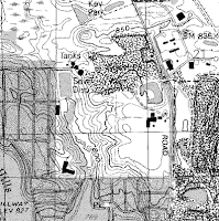
Georeferencing: The process of using digital aerial photography in a GIS requires a processing step known as registration or georeferencing. Aerial photographs have a nominal scale, but that scale is not constant throughout the frame. This registration process attempts to correct for scale changes and inherent photo distortions, as well as to add an earth-coordinate system, thereby allowing other digital layers with similar spatial coordinate systems to be co-registered with the photography. There are several methods for performing the registration process and various levels of accuracy associated with each method. The 1999 kelp survey employed two registration methods. In the initial phase of the project, sophisticated photogrammetric processing was used under ERDAS Orthobase, version 8.4, software. This process was applied to single frames of aerial photos and employed camera parameters, camera orientation and position, and corrected for scale changes due to terrain elevational changes.
As an alternative approach, a simpler affine transformation was used for georeferencing the aerial photography under ArcView v3.1/Image Analysis Extension, v1.0.
Indexing Aerial Photography:After georeferencing the kelp aerial photos, DFG prepared a separate ArcView shapefile for each photo series by source. A polygon (or "wire-frame") delineating the "footprint" or net coverage of each photo frame was screen-digitized over the photo display itself. "





.jpg)


