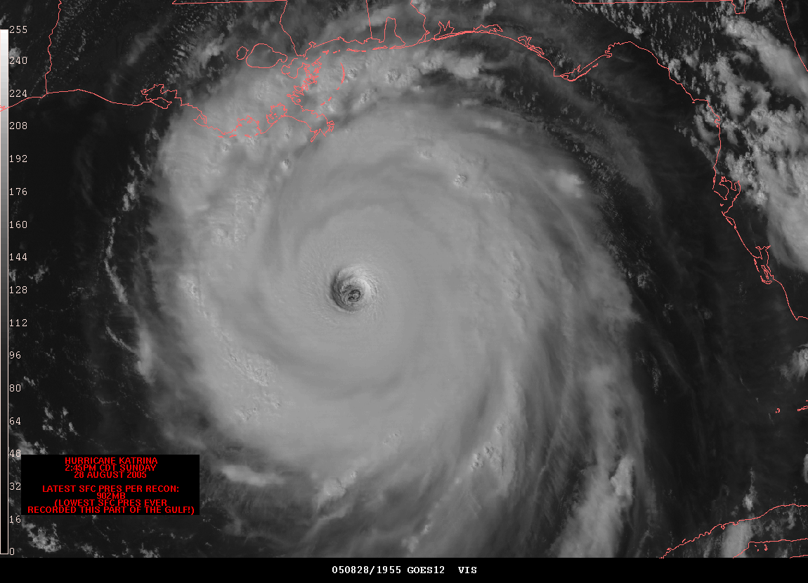
 Hurricane image: http://www.spc.noaa.gov/misc/carbin/katrina/kat5_1945.gif
Links to Flash animation: http://www.nola.com/katrina/graphics/flashflood.swf, http://www.zdnetasia.com/blogs/bcp/?d=200606 (original source).
This is a very basic example of cartographic animation with the use of a planimetric map enhanced with an animation of the devastation hurricane Katrina wrought. For this particular type in infromation, GIS technologies of digital raster graphics, digital line graphs, change detection, georectifcation, modeling and others were possibly employed. As mentioned in the last post, the multitude of uses and the creative, visually interesting ways geovisualization, cartography, and now animated cartography can be combined is tremendous. It has many possibilities, including the usual caveat we have learned about in class: the producers and users may bring their own inferences and messages to this form of communication. The use and interpretation of information may need to be analyzed carefully.
The article we read by Ralph Lengler and Martin J Eppler, "Towards a Periodic Table of Visualization Methods for Management strove to organize this large arena of information and possibilities and concepts relating to it for uses in management specialites. This is one of those post categories where I wish we were allowed to include more than one!
No comments:
Post a Comment