In general, contour lines join areas of equal value of the variable that is being measured and are also known as isopleths. The distance between the contour lines depict the rate of change in that third variable. If the distance between the lines is close, the rate of change is larger over a smaller distance. These lines are also know as isopleths. There are a variety of specialized isopleth maps. Examples include: bathymetrics (show sea floor elevation), isohyets (show rainfall), isopachs (show rock or sediment), isotachs (show wind speed), and isobars (show air pressure).

The above map illustrates isobars of air pressure. Where the lines are very close together, there is a larger rate of change in a small distance, and a resulting increase in air movement.
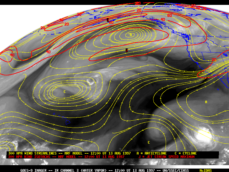
Isotachs in the image above connect areas of equal wind speed. This is from tropical storms over the pacifice in 1997.
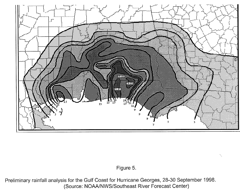
The areas of rainfall in the Florida panhandle are shown in the isohyets above for hurricane Georges in 1998.

The final image (above) for this section uses ispoachs and is showing the natural gas field in Texas known as Barnett Shale.
No comments:
Post a Comment