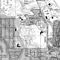
USGS Digital Raster Graphic (DRG)
pubs.usgs.gov/of/2003/of03-471/domier/index.html .

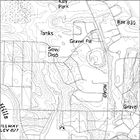
USGS Digital Lind Graph (DLG)
pubs.usgs.gov/of/2003/of03-471/domier/index.html .
The USGS has produced a series of georeferenced topograhpic maps. According to class notes, it was reviewed that this means they are "tied to a coordinate system, a datum and a map projection." These maps are also called "topoquads, taken from "topographic quadrangles". They represent rectangles in a scale of 1:24,000 where 1 inch equals 2000 feet, and cover an area 7.5 minutes latitude by 7.5 minuntes longitude.
DRGs (digital raster graphic) are images scanned from these topoquads. "Raster" is information that is based on pixels. DLGs (digital line graphic) are vector information, which is based on polygons, lines and points.
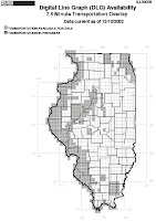
The DRG and DLG above are for the same location in Illinois and make a nice comparison. The outline of the state topoquad is included below for general reference.


http://ess.nrcan.gc.ca/ercc-rrcc/theme1/t9_e.php?p=1
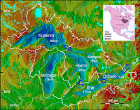
This Digital Elevation Model (DEM) of the Great Lakes. DEMs use raster (pixel) coding, similar to DRGs, and the color enhancement adds to the dimensional relief effect.

http://www.consrv.ca.gov/index/PublishingImages/You_are_here.jpg
The Department of Conservation in downtown Sacramento, California is shown by the arrow in this Digital Orhtoquarter Quad (DOQQ) image. DOQQs are georectified, georeferenced aerial photos. They are designed to remove the distortion that can occur with aerial photos, and have the benefit of more accurate measurement of positions and angles.
References for this post include class notes and pubs.usgs.gov/of/2003/of03-471/domier/index.html .
No comments:
Post a Comment